Moving Valmeyer
This is a quick summary of a project I did as part of the GIS Specialization offered by UC Davis via Coursera. So far it’s been a great series of courses that has allowed me to quickly learn the basics of both GIS in general and ArcGIS in particular.
Assignment
The assignment was to update one GIS layer and create another for the town of Valmeyer, IL after it moved (yes, you read that right, the whole town actually moved).
The layer I was tasked with updating was the town’s parcel information. For each parcel I had to add attributes that summarized the parcel’s elevation, slope, and distance from the old town.
The new layer I had to create was a simple roads layer for the new town.
I was given a geodatabase containing three items: a complete feature class of parcels from the old Valmeyer, an incomplete feature class of parcels from the new Valmeyer, and a raster digital elevation model for the area.
To complete the assignment I had to create a publicly available web map on ArcGIS Online with three layers: the old Valmeyer parcel layer, the now complete new Valmeyer parcel layer, and the new roads layer.
View my finished product here.
My Approach
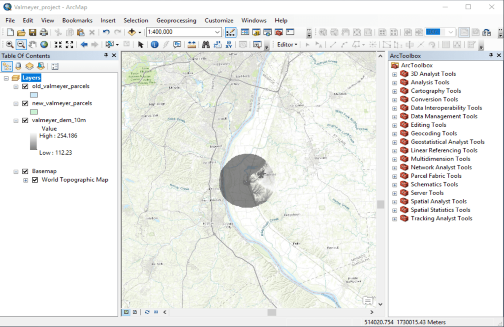
After loading in the three feature classes that were provided, I first tried to get some context by adding a basemap and then zooming out. In screenshot 1 below you can see the Mississippi river basin running North and South (more or less) and you can see the extent of the DEM data I had (the dark circle in the center).

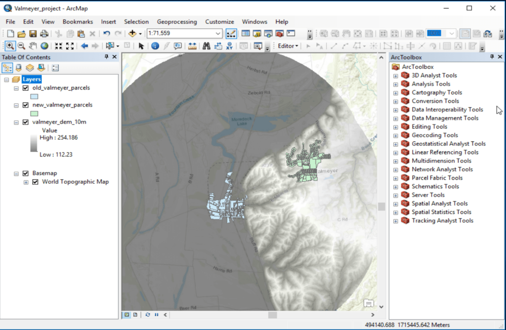
Zooming in a little bit you can see the old Valmeyer (blue) and new Valmeyer (green) parcel layers. And by looking at the DEM you can clearly see that old Valmeyer is in the Mississippi river basin at a much lower elevation than new Valmeyer:

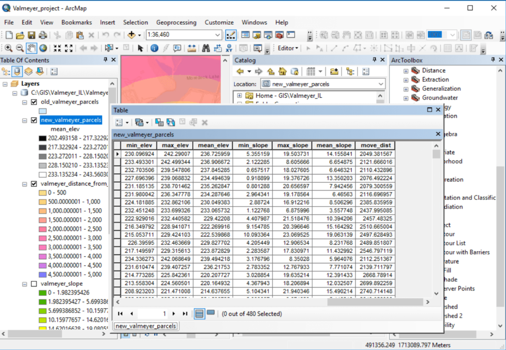
The first part of the assignment I decided to bite off was adding the elevation statistics to the new Valmeyer parcel feature class. I used a series of Spatial Analyst tools and was able to successfully calculate and add those attributes.
Next I added the slope statistics to the new Valmeyer parcel feature class by following a similar process (although there was one extra step to generate the slope data).
The last attribute I added was the average distance from the old town.
And you can see that all of those attributes are showing up as columns in the new Valmeyer attribute table:

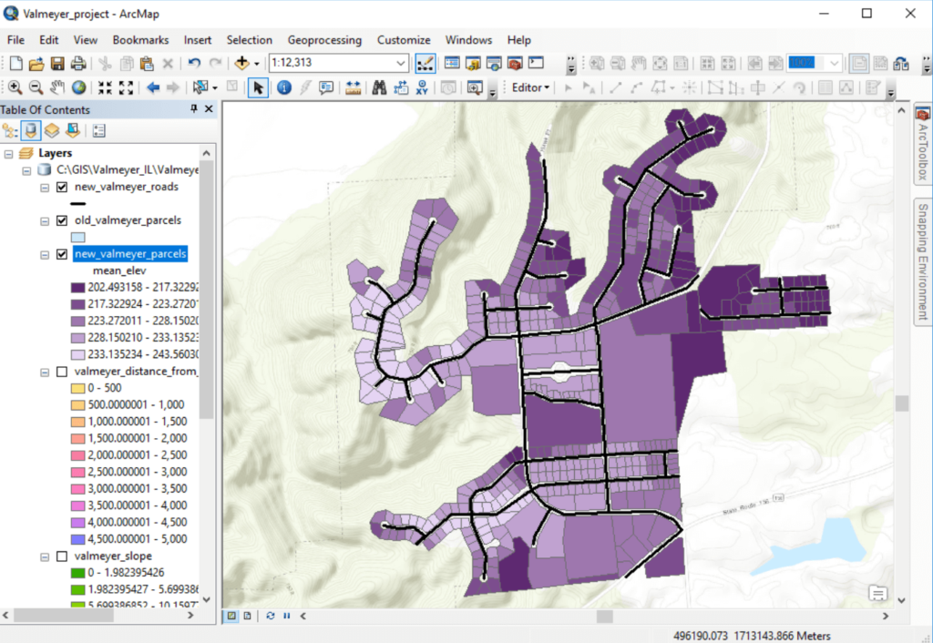
Next I needed to create a new feature class for new Valmeyer’s roads. This was a pretty basic digitizing exercise but it was useful for understanding the full process of creating a new layer from scratch.
The roads are the black lines shown in this screenshot:

Once I had finished preparing the three layers I saved them as shapefiles, uploaded them to a new web map on ArcGIS Online, updated the symbology, submitted the project, and called it a day!
Conclusion
I passed with a score of 20/21, with one point being taken off because I didn’t make the new Valmeyer layer visible at the initial scale of the web map. After receiving that feedback I changed it so that it was visible at a smaller scale.
Although in hindsight this project doesn’t seem all that complicated, it was really helpful for me as it was the most open-ended ArcGIS project I had done up to this point. Enough information was provided to complete the assignment, but it was up to me to figure out how to turn the data I was given into the output data that was requested. This really forced me to improve my awareness and understanding of some of the Spatial Analyst tools available.